Sunday, September 30, 2012

Hiking Uwharrie Trail

Friday evening set a good mood for Saturday's adventure. Passing Lake Crabtree on my bike ride home the water was almost as smooth as glass.

Saturday morning clouds in the distance would extend all the way from Raleigh down to Uwharrie.

The day's adventure began in earnest in advance of the trailhead. I made final preparations as Jason drove. GPS on, SPOT on and tracking, final gear check, pack assembly, and some gut check. GPS directions led down increasingly sketchy roads. When we turned left onto a gravel road clearly marred from recent logging activity we pulled executive override. We needed to find the trailhead fast so Jason could navigate the circuitous backroads in time to meet the rest of the jeeping club. We quickly found an alternate route which avoided crawling along in 4 Low.

We met the "trailhead" with skepticism. There was a reassuring large brown sign. That was the end of assurances. Neither Jason nor I could immediately spot a trail. I verbally assured him, and echoed to myself, that it was okay and there was a trail. I jumped out of the safety of the Jeep, applied last second anti-chafe, shouldered my pack, and changed mental gears for five hours of trail solitude. Jason drove out from the trail head. The throaty V8 faded into the distance.

I found the trail covered in rocks and heading up what appeared to be the steepest slope around. Time to get down to business.   

I needed an estimated time to finish the trail to prepare myself mentally and to arrange pickup details. The weekend before I hiked nine miles on Saturday at Pilot Mountain with fully loaded pack and then ran 17 trail miles on Sunday in Umstead. The nine mile leisure hike with friends took 5 hours. The 17 mile run took 3 hours. I heard at least one report from the good folks at Bull City Running that the Uwharrie trail cold be rough. My gut picked five hours. I can't point to any real mathematical proof of this estimate. Starting out on the trail five hours felt something between right and possibly a bit optimistic. I had a goal. Time to chase it.

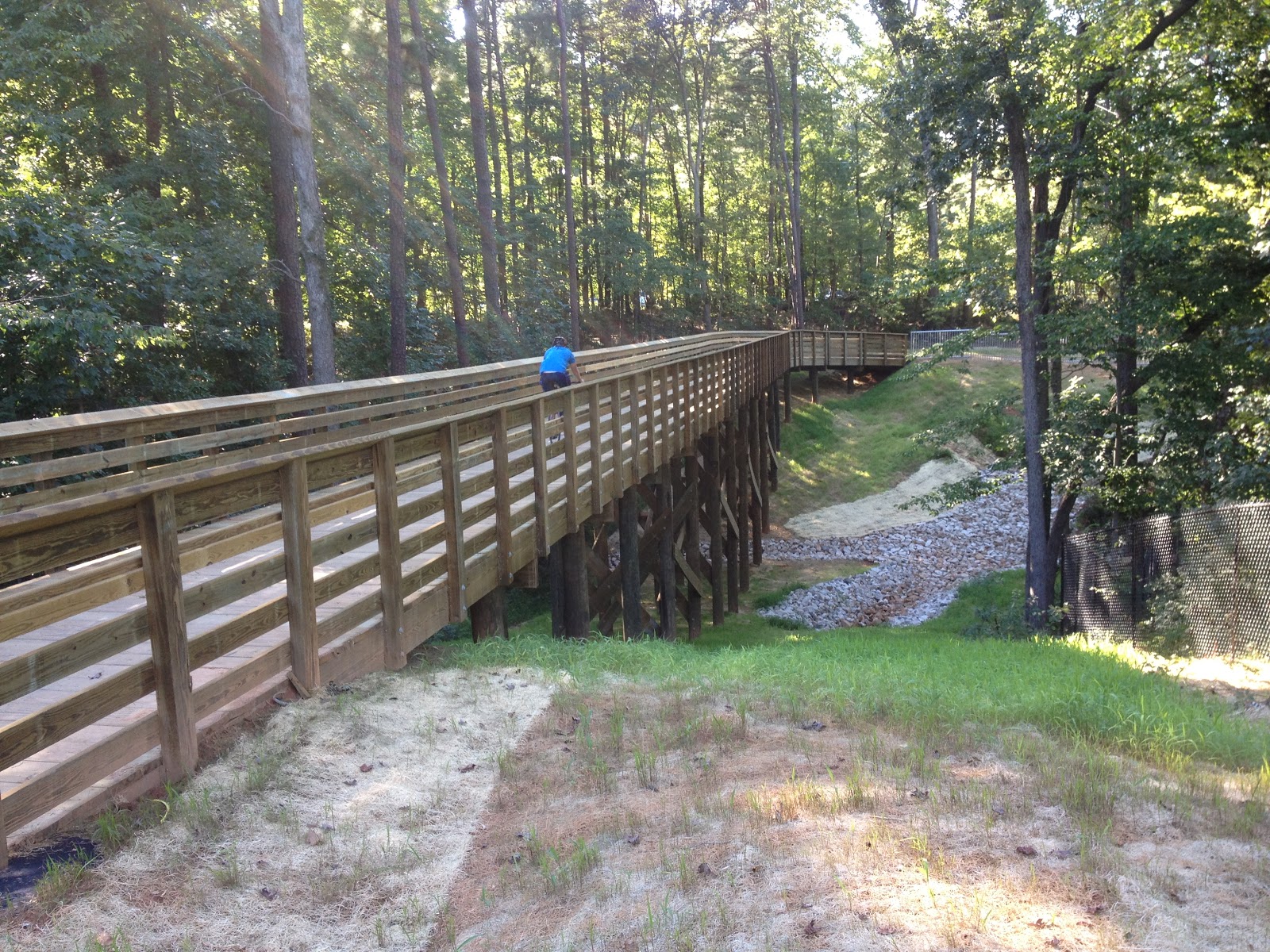
I saw two people within a mile of the start. Then it turned desolate. The trail was sparse. There were occasional signs of old camp sites. There were several stream crossings. These crossings were of the "good luck finding a way across" nature. At least the streams were small and rocks plentiful. I covered 4.3 miles in the first hour. That gave me just a few minutes of cushion. I needed to maintain 4 miles per hour to cover 20 miles in five hours. Around 1:18 in, or 5+ miles, I came to a bit of civilization in the form of a bridge.
This roadbed of the bridge sloped down to the right. The planks were slick as snot. I slid to the right just trying to walk across the bridge. Sliding must have been fun based on my smile.

Shortly thereafter the trail went back to more typical stream crossings.

I liked this trail marker for the "More Difficult" designation. Apparently ATVs are allowed on this section. I was happy to find no obvious ATV activity.

For the duration of the trail I thought "Appalachia".

There was some environmental variation in the 20 miles. There were rocky sections, very few flat sections, some clear evidence of burning, and in a few places the trail shrunk to "pig trail". My after impressions of the trail are keep your feet up and head down. Feet up because of rocks, roots, stumps, fallen trees, streams, and the "walk lightly" mentality that is required for rough terrain. Head down because of low branches, saplings, fallen trees, spider webs, fallen limbs, and a constant vigilance for a head/neck/shoulder/chest/gut check. Watch where your feet and your torso are going. Enjoy the open spaces but don't get lulled into complacency.

This is also where I got the heaviest rain of the day. Generally the canopy protected me from rain. I had a rain coat with me but never felt enough direct rain to stop and put it on.

A welcome rare sign of civilization.

This peak stood out among the other terrain. There were very few grassy open areas.
The subtle rocks in the picture above are a subtle hint at the trick trail footing in this area. The trail bed cut through a thin level of top soil onto something like a huge solid piece of rock. Some combination of moss and clay collected in a thin membrane atop the slab foundation. The resulting surface was like walking on greasy glass. These patches weren't really visually discernible. I recognized them only when I started sliding along for no apparent reason. This adds another item to the watch list - a fall zone. I managed to stay on my feet. For every step I was choosing my footing, checking the trajectory of my torso, and then thinking of a safe path to slide and fall. The trail isn't obviously difficult. It just subtly grinds away in a variety of ways.

I came through an adhoc camping area and was delighted to find the trail after casing the perimeter of the area. I was eight minutes ahead of schedule with one hour remaining. Note the white blaze on the tree in the left background. That was the route. Climbs never come through in pictures. The base of that tree was at least 6' up. The trail turned very noticeably up and hilly.

And Garmin gave up on routing. I've had this happen on 100+ mile bike routes before. This was a piddly little 20 mile trail. Come on Garmin.
The trail was very rough for a while. The terrain was difficult and then the underbrush complicated things further. For good portions of the trail I alternated swimming through neck high saplings and ducking under very low canopy. Gamin gave up on routing and the flora obscured trail markers. Eventually I popped out at a campground. This one bordered a forest service road and was clearly more heavily used.

I headed out of that campground on the forest service road. I was ~2.6 miles from the southern trailhead. If the last 2 miles were as bad as what I had been on then there was a chance I would miss Jason and my extraction. While double timing it down the forest service road Garmin came back to life just a little bit. This map rendering is wrong for many reasons. The most glaring problem is that I was ~2 miles from the southern trail head and heading south. The trial line should be continuous beside me, or ideally, under me. I have no idea where the trail is. I was on a forest service road that I remembered seeing on the map. The map and trail ended at the same location. With sketchy trail, bad navigation tool, and limited time I went with the forest service road.

This is the southern trail head on 24/27. I arrived at 2:40 a good 20 minutes ahead of schedule. I was glad to have time cushion. The trail was tough.

I fished the radio out of my pack, turned it on, and set out running down the highway in the agreed upon direction. I made it to River Road and started North. A couple miles up River Road Jason found me and my adventure came to an end. I was particularly glad to see Jason as I'd been out of water for 20 minutes. I drained 3L of water from my pack in 5 hours. It was nice to run lighter. It wasn't so no nice to consider being thirsty. There were a few houses along the road should it come to that.

We drove back to Raleigh in pouring rain. Mother nature decided to extend the adventure just a little bit longer.


Out of the forest I learned my SPOT had stopped updating. The lights were still flashing. It still showed to be in tracking mode. It just wasn't updating. I can appreciate it might not update in heavy cloud cover and pouring rain. I can't fathom why it wouldn't work while I was running down the road with clear view of the sky. I powered the SPOT off and back on and it did start updating. Then I forgot to power it off for the drive home. Here is what SPOT recorded:
 Spots 7 and 8 were while I was running on the road after rebooting the SPOT.

Garmin recorded the route even if it couldn't show the trail:

Technology is still marginal off the beaten path. If you're going to do these types of activities do plan on multiple levels of redundancy and most importantly plan to be self sufficient.

These 20 miles are challenging. Doing it in one direction gives much better perspective for considering the 40 mile Uwharrie Mountain Run.

Friday, September 28, 2012

Virtually Hike Uwharrie with me on Saturday

With help from Jason I'm heading off for a 20 mile hike in Uwharrie National Forest on Saturday:


Here is my spot tracker for the day. You'll have to remove the extra spaces from the url:
[deleted]

Ideally I will start around 10 am and finish within about 5 hours. If I finish earlier I will head west on 24/27 and north on River Road. That will take me back toward Eldorado Outpost and my ride home.

You can get a GPX file of the course here: [deleted] . Take that and upload it under the "Courses" tab at http://www.bikeroutetoaster.com/Course.aspx to see a map of the trail.

That directory also contains a PDF showing the route and terrain.

If you're stuck near a computer terminal join me virtually at the findmespot link above.

Sunday, September 23, 2012

Hiking Pilot Mountain

In my continuing exploration of hiking and biking locations plans finally came together for Pilot Mountain State Park. A couple friends and I set out for a day trip to cover the ~9 miles of hiking trails at Pilot Mountain. The mountain is quite a sight from nearby roads.

We parked near the Park Office and commenced hiking clockwise with plans to cover Grassy Ridge, Mountain, Ledge Spring, Jomeokee, and Grindstone trails. Grassy Ridge was uneventful other than one questionable trail intersection. This intersection provided the first indication of inaccuracy in park maps in the NC Pocket Ranger iPhone app. Eventually we made it down to Pinnacle Hotel Road and started back up on Mountain Trail. These were simple trails. That said navigation still required some interesting interpolation between the NC Pocket Ranger maps, GPS, and printed park map. Mountain Trail was a nice hike upward. Nuts falling from the mountain chestnut oak trees enlivened the hike. The nuts, around 1" in diameter, constantly thumbed the ground around us. Discussions of squirrels and birds hurling nuts at us proved thoroughly entertaining. Eventually I did get nailed by a falling nut during a nature break. While the blow didn't particularly hurt the strike seemed to give more credence to birds and squirrels attack from above. The distraction, or motivation, made it easy to progress up the slope.

For the first 4 miles we saw only a small handfull of hikers. Falling nuts and one wasp nest seemed the extent of activity. Then we ran head long into a huge pack of hikers. We were officially near the parking area atop the mountain and the associated droves of people. After swimming through the crowd we were treated to the unexpected entertainment of droves of climbers. Every few feet along the rock face groups of rock climbers were setup with safety ropes scaling the cliffs.

There were an impressive number of climbers out on the trail. They came with packs, ropes, and hammocks for a day on the natural sheer rock faces. I made myself dizzy a few times with eyes drifting up the cliffs taking in the rock faces and climbers while progressing down the trail.


We found a shady spot with a view, breeze, and natural seats to enjoy Subway sandwiches for lunch. After consuming some calories and lightening my load I felt like a dog off the leash. I was free to fleet up the trail somewhat to the chagrin of the group. After bounding out a bit of jubilant energy I fell back into line.

Three Bears Gulley felt like a place and sign just made for Rebecca and her love of the family Ursidae.

I was disappointed to learn there was no hiking or climbing to the top of the primary dome that draws the eye from miles around. A loop trail circumnavigates the dome with great views of these even more impressive rock faces.


Many views from the trails are obscured by trees and canopy. Near the parking lot atop the mountain there are observation decks with cleared views.


From Little Pinnacle Overlook looking to the north east are, from left to right, Sauratown Mountain, Hanging Rock, and then Pilot Mountain in the foreground. There is a Sauratown trail of ~20 miles running between the parks. This might be a future training run if I can figure out the logistics.

Little Pinnacle attracts bird watchers. I like to see sharing of information.


The park is setup to enable climbing and climbing safety. There is a climber in a red helmet at the bottom of this face. Note the tiedown affixed to the top of the wall. I know little about climbing but I like the approach. Two bolts in the rock faces. No single point of redundancy. Seems like a safe and convenient tiedown.

Heading back down the park map was again less than helpful. Grindstone trail splits off far west of what is indicated by NC Pocket Ranger map. Near the summit the nut assault from above diminished. The attacks were not over though. Nuts piled up on the trail. The nuts were remarkably marble-like in the roll-out-from-under-foot sort of way. We all skated on loose nuts multiple times while navigating down the mountain.

The rock faces and climbers at Pilot Mountain were novel. There were a couple of good views. In contrast Hanging Rock provides many views and, I think, more strenuous hiking opportunities.  Either way it was a great day on the trails with 2200 feet of elevation gain, 1200 calories burned, and 4 hours of hiking. This is an easy day trip from the Raleigh Durham area.

Saturday, September 15, 2012

Biking Raleigh Durham Greenways

It has been a while since I've explored all my favorite local trails. Umstead and I are close friends but what about the rest of the Raleigh Durham trails?

House Creek Greenway which connects Reedy Creek Greenway to Crabtree Creek Greenway is now complete. There is a nice bridge as you turn north onto House Creek from Reedy Creek. This is a critical connector for trail systems inside the Raleigh beltline.

I opted for the Specialized Tricross on this trip. It's still my get'r-done commuter. The cyclocross geometry and drop bars are sufficiently similar to road bike for speedy riding. The rear luggage rack and snap on panniers are another winning feature. 

Trail construction is underway for the American Tobacco Trail bridge over I-40 as well connector trails for the proximal existing ATT trails. I really love seeing trail construction. This is another critical connector. Today trail users must risk life and limb on Fayetteville road or NC-751 to cross I-40. The Fayetteville route is shorter but more daunting:
There is plenty of asphalt and plenty of traffic. I get nervous riding it. It simply isn't viable for a family or really even a group of cyclists.  The NC-751 options is slightly better but only in a questionable sort of way. The 751 route has side walks to escape traffic. However, in Durham it is illegal to bike on sidewalks. Given the option I use the sidewalks and it hasn't been a problem yet. Even in this route there are a few questionable crossings involving interstate on/off ramps.
Suffices to say the bridge over I-40 will be a great addition.


I also really enjoy exploring new areas. The connector trail from the I-40 bridge down to Massey Chapel road will not follow the original rail bed. I am interested to see if they put effort into leveling the new path to be as flat as the original rail bed.

One notable addition is the cows! Looks like Durham has been busy adding new cows. These are on Tobacco Road near DPAC. There are other new cows by Johnson Lexus. They are interesting flare and so give the feeling of a unified city.

One notably poor experience is the White Oak Creek trail under the I-540 Extension / Toll Road / Triangle Express Way / Western Wake Freeway.
The trail used to be complete prior to road construction. Now it appears road construction is complete and the trail is left butchered. It looks like new pavement was added to reach the road right of way. Then the pavement abruptly ends on both the eastern and western sides of the freeway. It is possible to pass under the freeway bridge but it is currently an obstacle course at best. Unbridged draining areas traverse the would be trial route on both sides of the freeway. It is currently hike-a-bike through mud, high weeds, and genuinely rough terrain. The rough terrain is the appalling artificial post-construction mess. Concurrently it has that "road construction finished" aesthetic. I am worried the trail will remain broken for some time. Again, this is NOT family friendly. Here's hoping Wake County continues their previous good practices on open spaces.


Monday, September 3, 2012

Biking High Bridge State Park

During the GAP and C&O bike trip in June I added two more rail trails to my resume: Western Maryland Rail Trail and Great Allegheny Passage. I really like rail trails as dedicated hike/bike paths with NO CARS. Coincidentally High Bridge state park is close enough for a weekend trip. The trip allowed me to scout the Tobacco Heritage trail which is currently under construction.

First Tobacco Heritage. I hoped it might be passable such that I could ride it rough for an added bit of adventure. The trail near Meherrin, VA is in rough shape and not easily passable. I will wait for official construction and check back later.

Tobacco Heritage trail looks very promising. I am excited about the construction and mileage potential.


High Bridge State Park and rail trail extends east and west from Farmville, VA. Coincidentally Farmville is a college town making for a great base of operations.

I admit it, I'm slacking on mileage. I took two days to cover this piddly 30 mile trail with two out and back routes of 30 miles each. That left plenty of leisure time. I really love this picture. The Moots is on the cartop roof rack. The hedges hide the car. The bike appears floating in the air. That's how it feels to ride the Moots with front and rear shocks unlocked - riding on a cushion of air. The sun was hot and pool was cool.

And that's why the call it High Bridge. I'm grateful the railroad infrastructure can be reclaimed and reused. Every time I'm on these trails I'm thankful for them. The trails are entertainment for me. The trails do attract and encourage locals to get out and move. It is safe and scenic outdoor play space. Sometimes I'm saddened to see the people on the trail. Then I remind myself they are on the trail, they are being active, and they likely would not be active otherwise. Three cheers for rail trails!!!


The eastern end of the trail. There are plans to extend this over into the next town. Currently the eastern end has a picnic table in the shade. It's a great place for a picnic.